Before you explore
A few things to know
Please read and agree to the following before accessing the map.
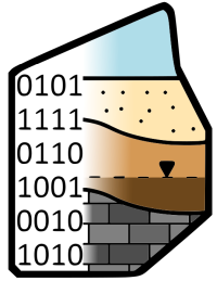
Data Sources
Information has been made available by various DOTs and other public agencies.
ML Predictions
Predictive models are probabilistic — they do not depict actual conditions at any specific site.
Planning Tool Only
Geosetta is a tool for planning subsurface investigations, not a substitute for one.
No Warranty
No claim as to accuracy is made or implied. No warranty or guarantee is included or intended.
The information made available through Geosetta has been compiled from various DOTs, public agencies, contributing data providers, and publicly available sources. The predictive models presented herein are based on machine learning tools applied to the data. The predicted subsurface conditions are a probabilistic model and do not depict the actual conditions at the site. No claim as to the accuracy of the data and predictive model is made or implied. No other representation, expressed or implied, is included or intended and no warranty or guarantee is included or intended in any Geosetta data or models. Data extracted, converted, or transformed from source documents, including documents supplied by users, provided by agencies, or obtained from publicly available sources, may contain transcription or conversion errors and is provided without warranty; the User is responsible for verifying such outputs against the source records. The User understands these limitations and that Geosetta is a tool for planning subsurface investigations and not a substitute for it. The User shall not redistribute, republish, or otherwise provide Geosetta predictions, models, or data outputs to any third party unless such outputs are accompanied by these same limitations and this disclaimer in full. Certain tools made available by or through Geosetta, including the DIGGS file viewer, are independent open-source software distributed under their own licenses; this disclaimer governs Geosetta-sourced data and outputs only, and neither restricts the User's rights in the User's own data nor alters the terms of any such open-source software. Where an output is derived solely from data the User supplied and incorporates no Geosetta-sourced data or model predictions, for example format conversion or extraction of the User's own uploaded document, that output is the User's data and the redistribution restriction above does not apply; outputs that incorporate Geosetta-sourced data or model predictions remain subject to it. In no event shall Geosetta or the Data Owners be liable to the User or another Party for any incidental, consequential, special, exemplary or indirect damages, lost business profits or lost data arising out of or in any way related to the use of information or data obtained from the Geosetta.org website, API, or associated tools and services.